Food nearby تجهيزات مشكور الغذائية
Iraq
Food nearby تجهيزات مشكور الغذائية
تجهيزات مشكور الغذائية
7925+76R, Baghdad, Baghdad Governorate, Iraq
contacts phone
:
+964 781 117 7633
Latitude:
33.2507337
, Longitude:
44.3580136
larger map & directions
read more
nearest Food
139 m
فولكينو برجر السيدية
Baghdad
Meal takeaway
Restaurant
Point of interest
Food
Establishment
read more
1.851 km
دكان ستي
شارع 16, بغداد
Meal takeaway
Restaurant
Point of interest
Food
Establishment
read more
2.364 km
اسماك حجي علي عوفي
68WM+F7M, شارع قطر الندى, Baghdad
Meal takeaway
Restaurant
Food
Point of interest
Establishment
read more
2.936 km
Samun Zahra furnaces
69JJ+W7W, Baghdad
Bakery
Food
Point of interest
Store
Establishment
read more
3.249 km
Olive Branches Restaurant
مقابل جزيرة الاعراس, القادسية مجاور, Al Jadriyah Bridge, Baghdad
Restaurant
Food
Point of interest
Establishment
read more
3.439 km
حلويات ومعجنات زينب
شارع الضغط, Baghdad
Bakery
Store
Food
Point of interest
Establishment
read more
3.498 km
مثنى
69JP+FXH, الدوره
Meal takeaway
Restaurant
Point of interest
Food
Establishment
read more
4.22 km
مطعم باربكيو ستيشن
Baghdad
Meal takeaway
Restaurant
Food
Point of interest
Establishment
read more
4.335 km
Ovens Olives
6CP2+HH6, Unnamed Rd،, Baghdad
Bakery
Store
Food
Point of interest
Establishment
read more
4.455 km
Chili House
79JQ+9R4, Jamia Street, Baghdad
Restaurant
Food
Point of interest
Establishment
read more
4.634 km
SIZIGY BURGERCLUB
Baghdad
Meal takeaway
Restaurant
Food
Point of interest
Establishment
read more
4.645 km
Abu-Al'amba Restaurant
698P+856, Baghdad
Restaurant
Food
Point of interest
Establishment
read more
4.653 km
Restaurant gardens and palm breezes
مجاور كلية الفارابي, Masafi Street, Baghdad
Restaurant
Point of interest
Food
Establishment
read more
4.751 km
Al-Yusur Market
7C35+XGH, Baghdad
Supermarket
Grocery or supermarket
Food
Point of interest
Store
Establishment
read more
4.814 km
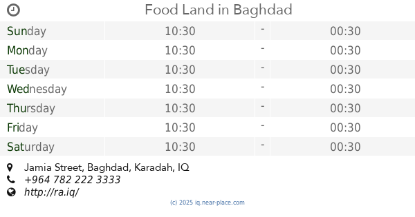
Food Land
79MV+276, Jamia Street, Baghdad
Restaurant
Point of interest
Food
Establishment
read more
📑
all categories
Accounting
Airport
Amusement park
Aquarium
Art gallery
Atm
Bakery
Bank
Bar
Beauty salon
Bicycle store
Book store
Bowling alley
Bus station
Cafe
Campground
Car dealer
Car rental
Car repair
Car wash
Casino
Cemetery
Church
City hall
Clothing store
Convenience store
Courthouse
Dentist
Department store
Doctor
Electrician
Electronics store
Embassy
Establishment
Finance
Fire station
Florist
Food
Funeral home
Furniture store
Gas station
General contractor
Grocery or supermarket
Gym
Hair care
Hardware store
Health
Hindu Temple
Home goods store
Hospital
Insurance agency
Jewelry store
Laundry
Lawyer
Library
Liquor store
Local government office
Locality
Locksmith
Lodging
Meal delivery
Meal takeaway
Mosque
Movie theater
Moving company
Museum
Neighborhood
Night club
Painter
Park
Parking
Pet store
Pharmacy
Physiotherapist
Place of worship
Plumber
Point of interest
Police
Political
Post office
Premise
Real estate agency
Restaurant
Roofing contractor
Route
Rv park, camping
School
Shoe store
Shopping mall
Spa
Stadium
Storage
Store
Sublocality
Supermarket
Synagogue
Taxi stand
Train station
Transit station
Travel agency
University
Veterinary care
Zoo
sublocality level 1
↑