Restaurant nearby Food Land
Iraq
Restaurant nearby Food Land
Food Land
Jamia Street, Baghdad, Karadah, IQ Iraq
contacts phone
:
+964 782 222 3333
website:
ra.iq
Latitude:
33.2825326
, Longitude:
44.3931539
larger map & directions
read more
nearest Restaurant
380 m
Chili House
79JQ+9R4, Jamia Street, Baghdad
Restaurant
Food
Point of interest
Establishment
read more
669 m
مطعم باربكيو ستيشن
Baghdad
Meal takeaway
Restaurant
Food
Point of interest
Establishment
read more
2.472 km
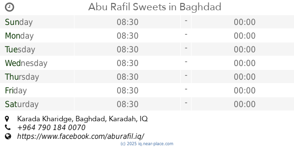
Abu Rafil Sweets
داخل الفرع, Karada Kharidge, Baghdad
Bakery
Store
Restaurant
Food
Point of interest
Establishment
read more
2.661 km
Olive Branches Restaurant
مقابل جزيرة الاعراس, القادسية مجاور, Al Jadriyah Bridge, Baghdad
Restaurant
Food
Point of interest
Establishment
read more
2.809 km
Restaurant gardens and palm breezes
مجاور كلية الفارابي, Masafi Street, Baghdad
Restaurant
Point of interest
Food
Establishment
read more
3.259 km
الزيتون
7CWF+3W3, Baghdad
Restaurant
Food
Point of interest
Establishment
read more
3.706 km
Mazin Gaming Hall
8958+2M5, شارع الكندي, Baghdad
Meal takeaway
Restaurant
Point of interest
Food
Establishment
read more
3.768 km
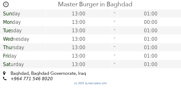
Master Burger
Baghdad
Restaurant
Point of interest
Food
Establishment
read more
3.885 km
Mondo Restaurant & Cafe
8C4F+JC6, Omar Bin Yasir Street, Baghdad
Restaurant
Food
Point of interest
Establishment
read more
3.89 km
SIZIGY BURGERCLUB
Baghdad
Meal takeaway
Restaurant
Food
Point of interest
Establishment
read more
3.922 km
Brothers Fish
8C4F+MHJ, Baghdad
Restaurant
Food
Point of interest
Establishment
read more
4.423 km
لحوم ومشويات الربيع
8988+3CW, Baghdad
Restaurant
Food
Point of interest
Establishment
read more
4.425 km
مطعم عباس النصراوي 2
8988+4C4, Baghdad
Restaurant
Point of interest
Food
Establishment
read more
4.707 km
Döner Kebab & Pide Hote
89CC+56G, Baghdad
Restaurant
Food
Point of interest
Establishment
read more
5.671 km
YUMMY ICE CREAM
89C3+73W, Baghdad
Restaurant
Food
Point of interest
Establishment
read more
📑
all categories
Accounting
Airport
Amusement park
Aquarium
Art gallery
Atm
Bakery
Bank
Bar
Beauty salon
Bicycle store
Book store
Bowling alley
Bus station
Cafe
Campground
Car dealer
Car rental
Car repair
Car wash
Casino
Cemetery
Church
City hall
Clothing store
Convenience store
Courthouse
Dentist
Department store
Doctor
Electrician
Electronics store
Embassy
Establishment
Finance
Fire station
Florist
Food
Funeral home
Furniture store
Gas station
General contractor
Grocery or supermarket
Gym
Hair care
Hardware store
Health
Hindu Temple
Home goods store
Hospital
Insurance agency
Jewelry store
Laundry
Lawyer
Library
Liquor store
Local government office
Locality
Locksmith
Lodging
Meal delivery
Meal takeaway
Mosque
Movie theater
Moving company
Museum
Neighborhood
Night club
Painter
Park
Parking
Pet store
Pharmacy
Physiotherapist
Place of worship
Plumber
Point of interest
Police
Political
Post office
Premise
Real estate agency
Restaurant
Roofing contractor
Route
Rv park, camping
School
Shoe store
Shopping mall
Spa
Stadium
Storage
Store
Sublocality
Supermarket
Synagogue
Taxi stand
Train station
Transit station
Travel agency
University
Veterinary care
Zoo
sublocality level 1
↑