School nearby مدرسة فلسطين للبنين
Iraq
School nearby مدرسة فلسطين للبنين
مدرسة فلسطين للبنين
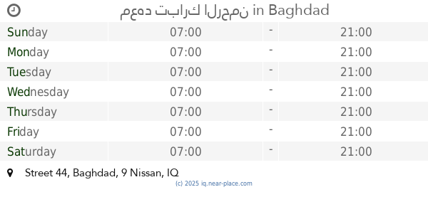
8G3F+823 بغداد الامين، Baghdad, Baghdad Governorate, Iraq
contacts phone
:
+964
Latitude:
33.3033125
, Longitude:
44.5225625
larger map & directions
read more
nearest School
1.901 km
اسواق كرار
8G74+JJ5, Baghdad
School
Point of interest
Establishment
read more
4.279 km
مدرسة ورود الجنة الأهلية النموذجية
8F7H+H82, Unnamed Road،, Baghdad
School
Point of interest
Establishment
read more
4.989 km
معهد تبارك الرحمن
33.332280,481766, Street 44
School
Point of interest
Establishment
read more
7.34 km
Al - Bawasel Primary School
8FH2+V3C, Baghdad
School
Point of interest
Establishment
read more
8.207 km
اكاديمية بغداد للعلوم الأنسانية
8C5M+MR6, Baghdad
School
Point of interest
Establishment
read more
8.222 km
الاعدادية النظامية للبنين
52 Wathiq Street, Baghdad
School
Point of interest
Establishment
read more
9.347 km
Al-Najat Secondary School For Girls
9F95+23X
School
Point of interest
Establishment
read more
11.174 km
مدرسة ابي سعيد الخدري
8CM5+94G, Baghdad
School
Point of interest
Establishment
read more
11.45 km
Beirut high school for distinguished students
الرصافة الاولى, بغداد
School
Point of interest
Establishment
read more
13.118 km
Mohamed Tayeb average for boys
CF56+WM8
School
Point of interest
Establishment
read more
13.728 km
Dar Flowers Rivers Nursery
79HH+46C, Baghdad
School
Point of interest
Establishment
read more
13.994 km
Bgahdad School of Music and Dance
899F+P7V, Damascus Street, Baghdad
School
Point of interest
Establishment
read more
14.474 km
Al-Mansour Foundation Mixed School
8999+64V, Baghdad
School
Point of interest
Establishment
read more
14.95 km
مدرسة حاتم الطائي الابتدائية المختلطة
99MV+GC9, Baghdad
School
Point of interest
Establishment
read more
16.941 km
Baghdad college Secondary School (Boys)
Baghdad
School
Point of interest
Establishment
read more
📑
all categories
Accounting
Airport
Amusement park
Aquarium
Art gallery
Atm
Bakery
Bank
Bar
Beauty salon
Bicycle store
Book store
Bowling alley
Bus station
Cafe
Campground
Car dealer
Car rental
Car repair
Car wash
Casino
Cemetery
Church
City hall
Clothing store
Convenience store
Courthouse
Dentist
Department store
Doctor
Electrician
Electronics store
Embassy
Establishment
Finance
Fire station
Florist
Food
Funeral home
Furniture store
Gas station
General contractor
Grocery or supermarket
Gym
Hair care
Hardware store
Health
Hindu Temple
Home goods store
Hospital
Insurance agency
Jewelry store
Laundry
Lawyer
Library
Liquor store
Local government office
Locality
Locksmith
Lodging
Meal delivery
Meal takeaway
Mosque
Movie theater
Moving company
Museum
Neighborhood
Night club
Painter
Park
Parking
Pet store
Pharmacy
Physiotherapist
Place of worship
Plumber
Point of interest
Police
Political
Post office
Premise
Real estate agency
Restaurant
Roofing contractor
Route
Rv park, camping
School
Shoe store
Shopping mall
Spa
Stadium
Storage
Store
Sublocality
Supermarket
Synagogue
Taxi stand
Train station
Transit station
Travel agency
University
Veterinary care
Zoo
sublocality level 1
↑