Point of interest nearby معرض حجر ليزا
Iraq
Point of interest nearby معرض حجر ليزا
معرض حجر ليزا
6CXC+GWP, Baghdad, Baghdad Governorate, Iraq
contacts phone
:
+964 770 343 0011
Latitude:
33.2488328
, Longitude:
44.4223353
larger map & directions
read more
nearest Point of interest
939 m
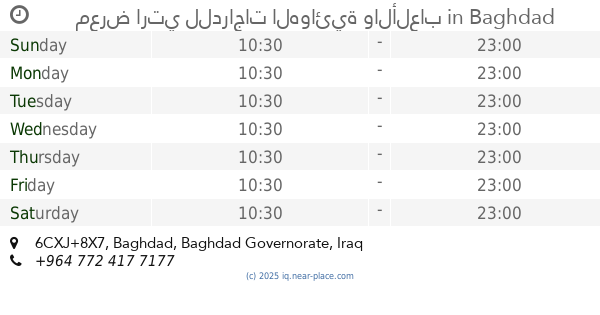
معرض ارتي للدراجات الهوائية والألعاب
6CXJ+8X7, Baghdad
Bicycle store
Point of interest
Store
Establishment
read more
971 m
Trand game
الجمعيه, Baghdad
Movie theater
Point of interest
Establishment
read more
1.161 km
معرض الامير للدراجات
6CX5+WXQ, Baghdad
Bicycle store
Store
Point of interest
Establishment
read more
1.239 km
Queen Lady Store
baghdad/aldora/Abo Teara St., Baghdad
Clothing store
Store
Point of interest
Establishment
read more
1.364 km
علي دسكاس
6CX5+P3V, اعدادية المعارف للبنين، بغداد،, Baghdad
Pet store
Point of interest
Store
Establishment
read more
1.424 km
Al-Yusur Market
7C35+XGH, Baghdad
Supermarket
Grocery or supermarket
Food
Point of interest
Store
Establishment
read more
1.616 km
القاعه الخضراء للاعراس والمناسبات
7C66+2GF, Masafi Street, Baghdad
Night club
Bar
Point of interest
Establishment
read more
1.634 km
Dijlah University College
Baghdad
University
Point of interest
Establishment
read more
1.722 km
فوج طوارئ المقر العام لمديرية شرطة الطاقة
7C78+CPW, الوزيرية الصناعية،، بغداد،, Baghdad
Police
Point of interest
Establishment
read more
1.765 km
خيمة الكبار
7C44+R9، بغداد،
Campground
Park
Lodging
Point of interest
Establishment
read more
1.812 km
Sultan markets
6CPP+R8Q, Baghdad
Shopping mall
Point of interest
Establishment
read more
2.095 km
نجارهocean
Abu Tayara Street, Baghdad
Painter
Moving company
Storage
Electrician
Point of interest
Establishment
read more
2.372 km
ساحة الجامع
6CM4+2P2، بغداد،
Night club
Bar
Point of interest
Establishment
read more
2.387 km
Ovens Olives
6CP2+HH6, Unnamed Rd،, Baghdad
Bakery
Store
Food
Point of interest
Establishment
read more
2.701 km
Tawhid Mosque
6CJ2+VF5, Baghdad
Mosque
Place of worship
Point of interest
Establishment
read more
📑
all categories
Accounting
Airport
Amusement park
Aquarium
Art gallery
Atm
Bakery
Bank
Bar
Beauty salon
Bicycle store
Book store
Bowling alley
Bus station
Cafe
Campground
Car dealer
Car rental
Car repair
Car wash
Casino
Cemetery
Church
City hall
Clothing store
Convenience store
Courthouse
Dentist
Department store
Doctor
Electrician
Electronics store
Embassy
Establishment
Finance
Fire station
Florist
Food
Funeral home
Furniture store
Gas station
General contractor
Grocery or supermarket
Gym
Hair care
Hardware store
Health
Hindu Temple
Home goods store
Hospital
Insurance agency
Jewelry store
Laundry
Lawyer
Library
Liquor store
Local government office
Locality
Locksmith
Lodging
Meal delivery
Meal takeaway
Mosque
Movie theater
Moving company
Museum
Neighborhood
Night club
Painter
Park
Parking
Pet store
Pharmacy
Physiotherapist
Place of worship
Plumber
Point of interest
Police
Political
Post office
Premise
Real estate agency
Restaurant
Roofing contractor
Route
Rv park, camping
School
Shoe store
Shopping mall
Spa
Stadium
Storage
Store
Sublocality
Supermarket
Synagogue
Taxi stand
Train station
Transit station
Travel agency
University
Veterinary care
Zoo
sublocality level 1
↑