Hospital nearby مستشفى النخيل الاهلي
Iraq
Hospital nearby مستشفى النخيل الاهلي
مستشفى النخيل الاهلي
Unnamed Road، HQ6Q+56W, Al Basrah, Basra Governorate, Iraq
contacts phone
:
+964
Latitude:
30.560488
, Longitude:
47.788091
larger map & directions
read more
nearest Hospital
1.037 km
Ports teaching hospital
GR4X+F5X
Hospital
Health
Point of interest
Establishment
read more
1.053 km
Al-Mawani Teaching Hospital
HQ2M+R6F, Basrah
Hospital
Health
Point of interest
Establishment
read more
1.054 km
Ports General Hospital
HQ2M+R6F, Basrah
Hospital
Health
Point of interest
Establishment
read more
1.098 km
طوارئ مستشفى الموانيءالتعليمي العام
HQ3J+2G7, Basrah
Hospital
Point of interest
Health
Establishment
read more
1.311 km
مستشفىالتعليمي
بصرة لاند, Dinar Street, Basrah
Hospital
Health
Point of interest
Establishment
read more
1.396 km
مركز المعقل للرعاية الصحية
HQ4F+6V4, Basrah
Hospital
Health
Point of interest
Establishment
read more
1.408 km
مركزطب الاسنان في المعقل
HQ4F+3W6, شارع النادي, Al Basrah
Hospital
Health
Point of interest
Establishment
read more
2.035 km
عيادات الحمزة الطبية التعاونية
GQVG+VX6
Hospital
Health
Point of interest
Establishment
read more
2.445 km
مركز الكوثر للرعاية الصحية
GQQJ+JXC, Basrah
Hospital
Health
Point of interest
Establishment
read more
2.638 km
مجمع البهو الطبي
GRQ2+VG7, شارع البهو, Al Basrah
Hospital
Health
Point of interest
Establishment
read more
2.731 km
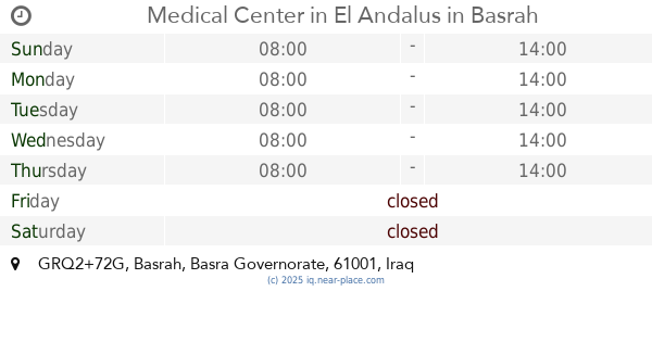
Medical Center in El Andalus
GRQ2+72G, Basrah
Hospital
Point of interest
Health
Establishment
read more
2.935 km
ردهة الانعاش والعناية المركزة
GQMM+PFR
Hospital
Health
Point of interest
Establishment
read more
3.026 km
Social welfare in the Charter
GQQ8+WXX, طريق عمارة - بصرة, البصرة
Hospital
Point of interest
Health
Establishment
read more
3.031 km
Al-Fayhaa Teaching Hospital
GQMM+C5P, Basrah
Hospital
Health
Point of interest
Establishment
read more
3.105 km
مركز الاساتذة للرعاية الصحية الاولية
GQPF+2W6, الاربع شوارع، بصرة،, Al Basrah
Hospital
Point of interest
Health
Establishment
read more
📑
all categories
Accounting
Airport
Amusement park
Aquarium
Art gallery
Atm
Bakery
Bank
Bar
Beauty salon
Bicycle store
Book store
Bowling alley
Bus station
Cafe
Campground
Car dealer
Car rental
Car repair
Car wash
Casino
Cemetery
Church
City hall
Clothing store
Convenience store
Courthouse
Dentist
Department store
Doctor
Electrician
Electronics store
Embassy
Establishment
Finance
Fire station
Florist
Food
Funeral home
Furniture store
Gas station
General contractor
Grocery or supermarket
Gym
Hair care
Hardware store
Health
Hindu Temple
Home goods store
Hospital
Insurance agency
Jewelry store
Laundry
Lawyer
Library
Liquor store
Local government office
Locality
Locksmith
Lodging
Meal delivery
Meal takeaway
Mosque
Movie theater
Moving company
Museum
Neighborhood
Night club
Painter
Park
Parking
Pet store
Pharmacy
Physiotherapist
Place of worship
Plumber
Point of interest
Police
Political
Post office
Premise
Real estate agency
Restaurant
Roofing contractor
Route
Rv park, camping
School
Shoe store
Shopping mall
Spa
Stadium
Storage
Store
Sublocality
Supermarket
Synagogue
Taxi stand
Train station
Transit station
Travel agency
University
Veterinary care
Zoo
sublocality level 1
↑