Establishment nearby صيطرة الشمعة
Iraq
Establishment nearby صيطرة الشمعة
صيطرة الشمعة
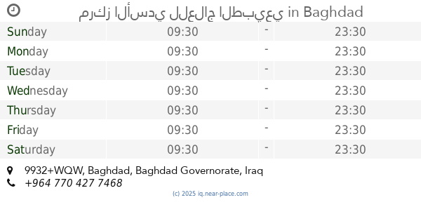
985V+HRC, Baghdad, Baghdad Governorate, Iraq
contacts phone
:
+964
Latitude:
33.3589973
, Longitude:
44.3445493
larger map & directions
read more
nearest Establishment
236 m
Hijry Hotel
986W+6FQ, Al Kadhim Street, Baghdad
Lodging
Point of interest
Establishment
read more
403 m
الفرن الشامي
984X+X9X, Baghdad
Meal takeaway
Restaurant
Point of interest
Food
Establishment
read more
664 m
Kadhimiya department of civil status
986Q+C4X, شارع المشاط, Baghdad
Local government office
Point of interest
Establishment
read more
752 m
Al-Karkh Baghdad Health Directorate
986P+FQJ, Baghdad
Local government office
Point of interest
Health
Establishment
read more
785 m
Test
60, Baghdad
Painter
Point of interest
Establishment
read more
826 m
مركز الأسدي للعلاج الطبيعي
9932+WQW, Baghdad
Physiotherapist
Health
Point of interest
Establishment
read more
829 m
سيارات الموال
9943+G8F, Baghdad
Moving company
Point of interest
Establishment
read more
830 m
Alsaahil fast food
988V+HWM, Imam Musa, Baghdad
Meal takeaway
Restaurant
Point of interest
Food
Establishment
read more
838 m
متحف الشيخ الوائلي Al-Waely Museum
988R+998, Baghdad
Museum
Point of interest
Establishment
read more
939 m
محمود ابو الفلافل
قرب جامع الحاج زيدان, بغداد
Meal takeaway
Restaurant
Point of interest
Food
Establishment
read more
985 m
مركز نور الامل للعلاج الطبيعي
9933+RFH, Baghdad
Physiotherapist
Health
Point of interest
Establishment
read more
1.076 km
مكتب
9933+RWQ, Baghdad
Lawyer
Point of interest
Establishment
read more
1.083 km
زهور سوفيليا 4
Baghdad
Florist
Store
Point of interest
Establishment
read more
1.16 km
السيد دودي
9983+CRQ, Baghdad
Hindu Temple
Place of worship
Point of interest
Establishment
read more
1.402 km
الشركة العامة لإدارة النقل الخاص
9924+23G, Baghdad
Local government office
Point of interest
Establishment
read more
📑
all categories
Accounting
Airport
Amusement park
Aquarium
Art gallery
Atm
Bakery
Bank
Bar
Beauty salon
Bicycle store
Book store
Bowling alley
Bus station
Cafe
Campground
Car dealer
Car rental
Car repair
Car wash
Casino
Cemetery
Church
City hall
Clothing store
Convenience store
Courthouse
Dentist
Department store
Doctor
Electrician
Electronics store
Embassy
Establishment
Finance
Fire station
Florist
Food
Funeral home
Furniture store
Gas station
General contractor
Grocery or supermarket
Gym
Hair care
Hardware store
Health
Hindu Temple
Home goods store
Hospital
Insurance agency
Jewelry store
Laundry
Lawyer
Library
Liquor store
Local government office
Locality
Locksmith
Lodging
Meal delivery
Meal takeaway
Mosque
Movie theater
Moving company
Museum
Neighborhood
Night club
Painter
Park
Parking
Pet store
Pharmacy
Physiotherapist
Place of worship
Plumber
Point of interest
Police
Political
Post office
Premise
Real estate agency
Restaurant
Roofing contractor
Route
Rv park, camping
School
Shoe store
Shopping mall
Spa
Stadium
Storage
Store
Sublocality
Supermarket
Synagogue
Taxi stand
Train station
Transit station
Travel agency
University
Veterinary care
Zoo
sublocality level 1
↑