Store nearby ماركيت سردار
Iraq
Store nearby ماركيت سردار
ماركيت سردار
Zaza Street, Erbil, Erbil, IQ Iraq
contacts phone
:
+964
Latitude:
36.1903866
, Longitude:
43.9986516
larger map & directions
read more
nearest Store
125 m
محل فاروق
5XRW+3WC, Zaza Street, Erbil
Supermarket
Grocery or supermarket
Store
Food
Point of interest
Establishment
read more
506 m
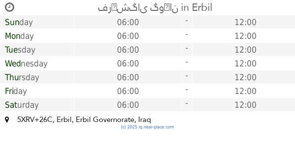
هفلان شارع 20
5XRV+26C, Erbil
Supermarket
Grocery or supermarket
Food
Point of interest
Store
Establishment
read more
506 m
شارى ئه لبان
5XRV+26C, Erbil
Supermarket
Grocery or supermarket
Store
Food
Point of interest
Establishment
read more
506 m
فرۆشگای گوڵان
5XRV+26C, Erbil
Supermarket
Grocery or supermarket
Store
Food
Point of interest
Establishment
read more
506 m
قوتابخانه ى دواناوندى بيرمه ندى كچان
5XRV+26C, ٤٠ مە تری, اربيل
Supermarket
Grocery or supermarket
Store
Food
Point of interest
Establishment
read more
653 m
چایخانەی جەسام_ جسام
52R4+49J, Erbil
Store
Cafe
Establishment
Point of interest
Food
read more
796 m
چايخانه بونى هيل
52Q5+P2R, Bata, Erbil
Food
Cafe
Point of interest
Establishment
Store
read more
813 m
چايخانه سهرسهنگ
52Q5+M2H, Bata, Erbil
Establishment
Point of interest
Cafe
Food
Store
read more
817 m
geab and go
52Q5+R3H, Erbil
Establishment
Cafe
Food
Store
Point of interest
read more
835 m
Grab n‘go
52Q5+P4G, Bata, Erbil
Establishment
Store
Food
Point of interest
Cafe
read more
840 m
Kafe nabar wan
52Q5+H4Q, شارع الباتا، اربيل،،, Erbil
Establishment
Point of interest
Store
Food
Cafe
read more
855 m
شه وانى باته
52Q5+949, Erbil
Store
Establishment
Cafe
Point of interest
Food
read more
985 m
كافى قلعه الاثري
52Q5+RR3, Erbil
Point of interest
Food
Cafe
Store
Establishment
read more
991 m
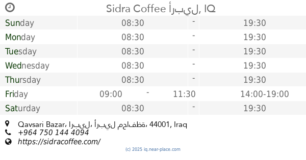
Sidra Coffee
Qaysari Bazar, Erbil
Establishment
Cafe
Food
Store
Point of interest
Restaurant
read more
1.376 km
الجاسم
52X5+MQ9, اراس، اربيل،, Erbil
Supermarket
Grocery or supermarket
Store
Food
Point of interest
Establishment
read more
📑
all categories
Accounting
Airport
Amusement park
Aquarium
Art gallery
Atm
Bakery
Bank
Bar
Beauty salon
Bicycle store
Book store
Bowling alley
Bus station
Cafe
Campground
Car dealer
Car rental
Car repair
Car wash
Casino
Cemetery
Church
City hall
Clothing store
Convenience store
Courthouse
Dentist
Department store
Doctor
Electrician
Electronics store
Embassy
Establishment
Finance
Fire station
Florist
Food
Funeral home
Furniture store
Gas station
General contractor
Grocery or supermarket
Gym
Hair care
Hardware store
Health
Hindu Temple
Home goods store
Hospital
Insurance agency
Jewelry store
Laundry
Lawyer
Library
Liquor store
Local government office
Locality
Locksmith
Lodging
Meal delivery
Meal takeaway
Mosque
Movie theater
Moving company
Museum
Neighborhood
Night club
Painter
Park
Parking
Pet store
Pharmacy
Physiotherapist
Place of worship
Plumber
Point of interest
Police
Political
Post office
Premise
Real estate agency
Restaurant
Roofing contractor
Route
Rv park, camping
School
Shoe store
Shopping mall
Spa
Stadium
Storage
Store
Sublocality
Supermarket
Synagogue
Taxi stand
Train station
Transit station
Travel agency
University
Veterinary care
Zoo
sublocality level 1
↑