Restaurant nearby كاهي
Iraq
Restaurant nearby كاهي
كاهي
Court Street, Sulaymaniyah, Sulaymaniyah, IQ Iraq
contacts phone
:
+964
Latitude:
35.5606516
, Longitude:
45.4418764
larger map & directions
read more
nearest Restaurant
8 m
Sardar Kabab - كەبابی وەستا سەردار
HC6R+7Q8, Court Street, Sulaymaniyah
Restaurant
Food
Point of interest
Establishment
read more
18 m
كباب برهم
HC6R+6MP, Court Street, Sulaymaniyah
Restaurant
Food
Point of interest
Establishment
read more
39 m
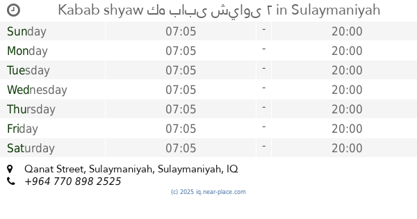
Kabab shyaw كه بابى شياوى ٢
HC6R+5Q7, shexan /sulaimanyah،, Qanat Street, Sulaymaniyah
Restaurant
Food
Point of interest
Establishment
read more
117 m
Rizgar restaurant
HC6R+665, Sulaymaniyah
Restaurant
Food
Point of interest
Establishment
read more
143 m
Dublin Restaurant
HC6R+C5J, Unnamed Road, Sulaymaniyah
Restaurant
Food
Point of interest
Establishment
read more
193 m
هنا اكو محل زين
HC5V+RC6, Sulaymaniyah
Restaurant
Food
Point of interest
Establishment
read more
193 m
Grily aron
HC5V+RC6, Sulaymaniyah
Restaurant
Food
Point of interest
Establishment
read more
278 m
Kaiwan's Breakfast Cafe
HC5V+72J, Sulaymaniyah
Restaurant
Food
Point of interest
Establishment
read more
315 m
Falafel-Shwarma
HC5R+4XW, Sulaymaniyah
Restaurant
Food
Point of interest
Establishment
read more
345 m
Nergsin Restaurant
HC5R+2PF, Sulaymaniyah
Restaurant
Food
Point of interest
Establishment
read more
348 m
Omer Hussein Restaurant
HC5Q+5XF, Kaneskan Street, Sulaymaniyah
Restaurant
Food
Point of interest
Establishment
read more
354 m
Shekha Kabab
HC4R+XVX, Sulaymaniyah
Restaurant
Food
Point of interest
Establishment
read more
371 m
مطعم ناز ناز
HC4R+WXQ, Sulaymaniyah
Restaurant
Food
Point of interest
Establishment
read more
419 m
Haji Aziz Restaurant
HC5Q+3HH, Sulaymaniyah
Restaurant
Food
Point of interest
Establishment
read more
420 m
Rangin Restaurant
HC4R+QJ5, Unnamed Road, Sulaymaniyah
Restaurant
Food
Point of interest
Establishment
read more
📑
all categories
Accounting
Airport
Amusement park
Aquarium
Art gallery
Atm
Bakery
Bank
Bar
Beauty salon
Bicycle store
Book store
Bowling alley
Bus station
Cafe
Campground
Car dealer
Car rental
Car repair
Car wash
Casino
Cemetery
Church
City hall
Clothing store
Convenience store
Courthouse
Dentist
Department store
Doctor
Electrician
Electronics store
Embassy
Establishment
Finance
Fire station
Florist
Food
Funeral home
Furniture store
Gas station
General contractor
Grocery or supermarket
Gym
Hair care
Hardware store
Health
Hindu Temple
Home goods store
Hospital
Insurance agency
Jewelry store
Laundry
Lawyer
Library
Liquor store
Local government office
Locality
Locksmith
Lodging
Meal delivery
Meal takeaway
Mosque
Movie theater
Moving company
Museum
Neighborhood
Night club
Painter
Park
Parking
Pet store
Pharmacy
Physiotherapist
Place of worship
Plumber
Point of interest
Police
Political
Post office
Premise
Real estate agency
Restaurant
Roofing contractor
Route
Rv park, camping
School
Shoe store
Shopping mall
Spa
Stadium
Storage
Store
Sublocality
Supermarket
Synagogue
Taxi stand
Train station
Transit station
Travel agency
University
Veterinary care
Zoo
sublocality level 1
↑