Night club nearby תני
Iraq
Night club nearby תני
תני
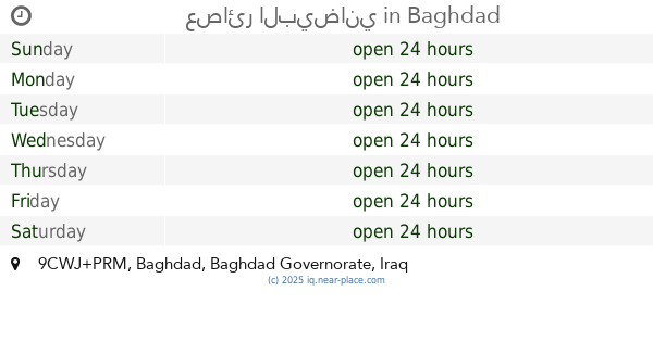
9CF5+3VC, Baghdad, Baghdad Governorate, Iraq
contacts phone
:
+964
Latitude:
33.3727151
, Longitude:
44.4096116
larger map & directions
read more
nearest Night club
195 m
ابو حرب
الاقسام الداخلية للجامعة المستنصرية, Baghdad
Night club
Point of interest
Establishment
read more
2.993 km
معمل عصام النجار لدوشمه والديكور
997H+FP6, Meghreb Street, Baghdad
Night club
Bar
Point of interest
Establishment
read more
3.395 km
عصائر البيضاني
9CWJ+PRM, Baghdad
Night club
Point of interest
Establishment
read more
3.445 km
Mini haifa St.
998F+M7W, Baghdad
Night club
Point of interest
Establishment
read more
3.934 km
اكل شعبي
99RF+98M, Baghdad
Night club
Point of interest
Establishment
read more
4.111 km
دمبلة القصر بلاتينيوم
Adhamiya Palace, Corniche Street, Baghdad
Night club
Point of interest
Establishment
read more
5.08 km
المطعم البغدادي
89HX+442, Baghdad
Night club
Point of interest
Establishment
read more
6.198 km
افاري بغداد
8C87+RVR, Baghdad
Night club
Point of interest
Establishment
read more
6.403 km
نايت ڤينيسيا
8C89+7J8, Baghdad
Night club
Point of interest
Establishment
read more
6.579 km
قاعة ريحانة الملكية
8FH4+584, شارع الربيعي، بغداد،, Baghdad
Night club
Point of interest
Establishment
read more
6.709 km
قاعة نغم الاوتار 2
8C7G+HCQ, ساحة الأندلس, بغداد
Night club
Point of interest
Establishment
read more
6.716 km
قاعه الصفوه الملكيه
8FH5+462, Baghdad
Night club
Point of interest
Establishment
read more
7.562 km
كروري الكوري
السعادة, بغداد
Night club
Point of interest
Establishment
read more
9.947 km
بيت بيوت
88J7+MR3, Baghdad
Night club
Point of interest
Establishment
read more
11.77 km
مولدة الكواد
97HM+C6C, Baghdad
Night club
Point of interest
Establishment
read more
📑
all categories
Accounting
Airport
Amusement park
Aquarium
Art gallery
Atm
Bakery
Bank
Bar
Beauty salon
Bicycle store
Book store
Bowling alley
Bus station
Cafe
Campground
Car dealer
Car rental
Car repair
Car wash
Casino
Cemetery
Church
City hall
Clothing store
Convenience store
Courthouse
Dentist
Department store
Doctor
Electrician
Electronics store
Embassy
Establishment
Finance
Fire station
Florist
Food
Funeral home
Furniture store
Gas station
General contractor
Grocery or supermarket
Gym
Hair care
Hardware store
Health
Hindu Temple
Home goods store
Hospital
Insurance agency
Jewelry store
Laundry
Lawyer
Library
Liquor store
Local government office
Locality
Locksmith
Lodging
Meal delivery
Meal takeaway
Mosque
Movie theater
Moving company
Museum
Neighborhood
Night club
Painter
Park
Parking
Pet store
Pharmacy
Physiotherapist
Place of worship
Plumber
Point of interest
Police
Political
Post office
Premise
Real estate agency
Restaurant
Roofing contractor
Route
Rv park, camping
School
Shoe store
Shopping mall
Spa
Stadium
Storage
Store
Sublocality
Supermarket
Synagogue
Taxi stand
Train station
Transit station
Travel agency
University
Veterinary care
Zoo
sublocality level 1
↑