Hospital nearby مجمع ابن البيطار الطبي
Iraq
Hospital nearby مجمع ابن البيطار الطبي
مجمع ابن البيطار الطبي
شارع المثنى, Najaf, Najaf, IQ Iraq
contacts phone
:
+964
Latitude:
32.0008973
, Longitude:
44.3462944
larger map & directions
read more
nearest Hospital
122 m
مجمع الامراء
282W+GXP, Najaf
Hospital
Point of interest
Health
Establishment
read more
137 m
مركز الرازي الطبي
شارع المثنى, Najaf
Hospital
Health
Point of interest
Establishment
read more
161 m
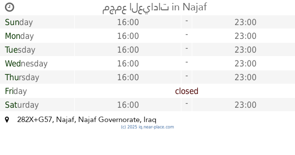
مجمع العيادات
282X+G57, Najaf
Hospital
Health
Point of interest
Establishment
read more
195 m
مستشفى المثنى الاهلي
مقابل مركز الرازي -مجمع فرح الطبي, شارع المثنى, Najaf
Hospital
Health
Point of interest
Establishment
read more
429 m
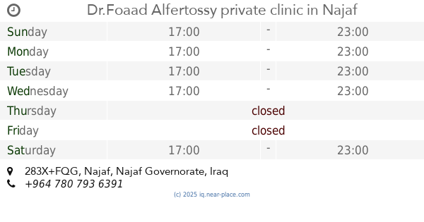
Dr.Foaad Alfertossy private clinic
283X+FQG, Najaf
Hospital
Health
Point of interest
Establishment
read more
460 m
مذخر ادوية فيتامين النجف
X8XV+538, شارع المثنى, Najaf
Hospital
Health
Point of interest
Establishment
read more
497 m
مركز ميليسا الطبي
284W+9FQ, Al Iskan Bridge, الكوفة
Hospital
Health
Point of interest
Establishment
read more
548 m
Amal Al Hayat Hospital
X8WV+C6P، النجف،
Hospital
Health
Point of interest
Establishment
read more
607 m
د حيدر ناظم الجبري اختصاص جراحة الاطفال
Najaf
Hospital
Health
Point of interest
Establishment
read more
634 m
مختبر البايلوجي محمد عبدالخالق المحنة
284X+FFQ
Hospital
Point of interest
Health
Establishment
read more
775 m
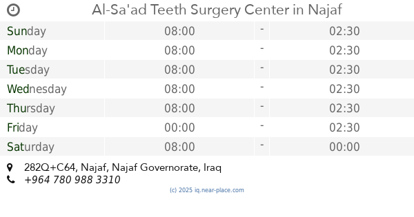
Al-Sa'ad Teeth Surgery Center
282Q+C64, Najaf
Hospital
Health
Point of interest
Establishment
read more
785 m
مركز السعد التخصصي لطب الأسنان
282Q+954, Najaf
Hospital
Health
Point of interest
Establishment
read more
854 m
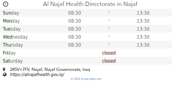
Al Najaf Health Directorate
285V+7FV, Najaf
Hospital
Health
Point of interest
Establishment
read more
988 m
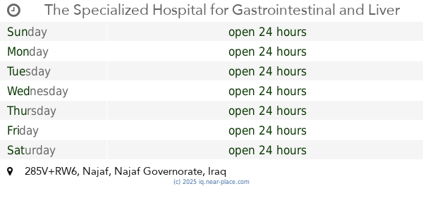
The Specialized Hospital for Gastrointestinal and Liver Diseases and Surgery
285V+RW6, Najaf
Hospital
Health
Point of interest
Establishment
read more
1.184 km
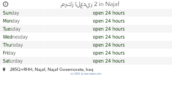
مركز الغدير 2
285Q+RHH, Najaf
Hospital
Health
Point of interest
Establishment
read more
📑
all categories
Accounting
Airport
Amusement park
Aquarium
Art gallery
Atm
Bakery
Bank
Bar
Beauty salon
Bicycle store
Book store
Bowling alley
Bus station
Cafe
Campground
Car dealer
Car rental
Car repair
Car wash
Casino
Cemetery
Church
City hall
Clothing store
Convenience store
Courthouse
Dentist
Department store
Doctor
Electrician
Electronics store
Embassy
Establishment
Finance
Fire station
Florist
Food
Funeral home
Furniture store
Gas station
General contractor
Grocery or supermarket
Gym
Hair care
Hardware store
Health
Hindu Temple
Home goods store
Hospital
Insurance agency
Jewelry store
Laundry
Lawyer
Library
Liquor store
Local government office
Locality
Locksmith
Lodging
Meal delivery
Meal takeaway
Mosque
Movie theater
Moving company
Museum
Neighborhood
Night club
Painter
Park
Parking
Pet store
Pharmacy
Physiotherapist
Place of worship
Plumber
Point of interest
Police
Political
Post office
Premise
Real estate agency
Restaurant
Roofing contractor
Route
Rv park, camping
School
Shoe store
Shopping mall
Spa
Stadium
Storage
Store
Sublocality
Supermarket
Synagogue
Taxi stand
Train station
Transit station
Travel agency
University
Veterinary care
Zoo
sublocality level 1
↑