Food nearby داي علي للسكائرDayı Ali Marketi
Iraq
Food nearby داي علي للسكائرDayı Ali Marketi
داي علي للسكائرDayı Ali Marketi
F98V+7JJ, Kirkuk, Kirkuk Governorate, Iraq
contacts phone
:
+964
Latitude:
35.4654705
, Longitude:
44.3941899
larger map & directions
read more
nearest Food
325 m
مكتب هيمن لبيع جميع أنواع الحليب
F98R+M9F, Kirkuk
Supermarket
Grocery or supermarket
Point of interest
Food
Store
Establishment
read more
585 m
سين كافيه -seen cafe
F9FQ+94V، كركوك،
Cafe
Food
Point of interest
Store
Establishment
read more
817 m
مأكولات هدى الرحمن
Mehakim Otobüs Durağı, Atles Caddesi, Kirkuk
Restaurant
Food
Point of interest
Establishment
read more
931 m
سندويش ايبو
F99M+RV7, Kirkuk
Restaurant
Food
Point of interest
Establishment
read more
932 m
كاهي وگيمر سنونو شارع اطلس
F99M+MX8, Kirkuk
Restaurant
Food
Point of interest
Establishment
read more
947 m
Coffee shop Bab El Hara
F9CP+PV2, Kirkuk
Cafe
Food
Store
Point of interest
Establishment
read more
1.052 km
مطعم وكافيه عنب
F96M+JCH, Kirkuk
Cafe
Food
Point of interest
Store
Establishment
read more
1.086 km
انس الطائي للاسماك المقلية والمسگوف
F9CM+3CX, Kirkuk
Restaurant
Point of interest
Food
Establishment
read more
1.112 km
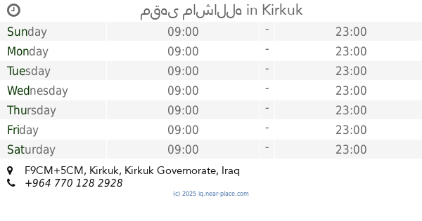
مقهى ماشالله
F9CM+5CM, Kirkuk
Cafe
Food
Point of interest
Establishment
read more
1.117 km
منورة چاي خانسى
F9CM+MRV, شارع الجمهورية، كركوك،, Kirkuk
Cafe
Food
Point of interest
Establishment
read more
1.118 km
قاپوتەکان
F9CM+6C8, Kirkuk
Cafe
Food
Point of interest
Establishment
read more
1.119 km
مقهى القاهرة
F9CM+7C4, Republic Street, Kirkuk
Cafe
Food
Point of interest
Establishment
read more
1.145 km
چاي دلشاد
F9CM+XXM, Kirkuk
Cafe
Food
Point of interest
Establishment
read more
1.161 km
أسواق محمد اولكر
F9CM+C88, Kirkuk
Supermarket
Grocery or supermarket
Store
Point of interest
Food
Establishment
read more
1.262 km
Ülker
F9FP+Q7M, Kirkuk
Supermarket
Point of interest
Grocery or supermarket
Store
Food
Establishment
read more
📑
all categories
Accounting
Airport
Amusement park
Aquarium
Art gallery
Atm
Bakery
Bank
Bar
Beauty salon
Bicycle store
Book store
Bowling alley
Bus station
Cafe
Campground
Car dealer
Car rental
Car repair
Car wash
Casino
Cemetery
Church
City hall
Clothing store
Convenience store
Courthouse
Dentist
Department store
Doctor
Electrician
Electronics store
Embassy
Establishment
Finance
Fire station
Florist
Food
Funeral home
Furniture store
Gas station
General contractor
Grocery or supermarket
Gym
Hair care
Hardware store
Health
Hindu Temple
Home goods store
Hospital
Insurance agency
Jewelry store
Laundry
Lawyer
Library
Liquor store
Local government office
Locality
Locksmith
Lodging
Meal delivery
Meal takeaway
Mosque
Movie theater
Moving company
Museum
Neighborhood
Night club
Painter
Park
Parking
Pet store
Pharmacy
Physiotherapist
Place of worship
Plumber
Point of interest
Police
Political
Post office
Premise
Real estate agency
Restaurant
Roofing contractor
Route
Rv park, camping
School
Shoe store
Shopping mall
Spa
Stadium
Storage
Store
Sublocality
Supermarket
Synagogue
Taxi stand
Train station
Transit station
Travel agency
University
Veterinary care
Zoo
sublocality level 1
↑