Establishment nearby دار اليهود
Iraq
Establishment nearby دار اليهود
دار اليهود
H86C+2R8, Taji, Saladin Governorate, Iraq
contacts phone
:
+964
Latitude:
33.5600832
, Longitude:
44.3220664
larger map & directions
read more
nearest Establishment
6.686 km
مجمع المحاكم في الزهور
G9JP+V99, Hosseinia
Courthouse
Local government office
Point of interest
Establishment
read more
7.071 km
الفلكة الاولى
G789+5C3, Taji
Fire station
Point of interest
Establishment
read more
7.319 km
مديرية المرور العامة - الحسينية
G9CP+XPQ, Hosseinia
Police
Point of interest
Establishment
read more
7.475 km
Firefighter Husseiniya
G9QX+C95, Hosseinia
Fire station
Point of interest
Establishment
read more
7.535 km
Al Taji
G785+MRP, Taji
Airport
Point of interest
Establishment
read more
7.644 km
Medium Abi Tamam Boys
GCR2+CG4, Hosseinia
School
Point of interest
Establishment
read more
7.672 km
مدرسة يعرب الاساسية للبنات / مدرسة ابن العربي للبنين
مدرسة يعرب الاساسية, 2, قرية الانتصار
School
Point of interest
Establishment
read more
7.772 km
Sharifi Supermarket
GCW4+44W, Hosseinia
Shopping mall
Point of interest
Establishment
read more
10.885 km
مكان غسل الاموات
الطارمية_المشاهدة،قرية حريش العواد، قرب جامع الخضر, المشاهدة
Funeral home
Point of interest
Establishment
read more
12.336 km
اترو
G663+P4, Taji
Synagogue
Place of worship
Point of interest
Establishment
read more
13.096 km
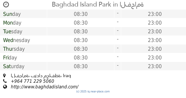
Baghdad Island Park
الفحامة
Park
Point of interest
Establishment
read more
13.34 km
مضيف مصطفى العبيدي
C8RM+6RH, Tajiyat
Campground
Park
Lodging
Point of interest
Establishment
read more
14.726 km
Medium School Falcons for Boys
شارع الجامع
School
Point of interest
Establishment
read more
17.471 km
Olympic Stadium
CCVX+76W, شارع اور, الحي السكني الاول للطاقة
Stadium
Point of interest
Establishment
read more
20.024 km
Hamidia Tower 4 Internet Services
CFH9+39H
Shopping mall
Point of interest
Establishment
read more
📑
all categories
Accounting
Airport
Amusement park
Aquarium
Art gallery
Atm
Bakery
Bank
Bar
Beauty salon
Bicycle store
Book store
Bowling alley
Bus station
Cafe
Campground
Car dealer
Car rental
Car repair
Car wash
Casino
Cemetery
Church
City hall
Clothing store
Convenience store
Courthouse
Dentist
Department store
Doctor
Electrician
Electronics store
Embassy
Establishment
Finance
Fire station
Florist
Food
Funeral home
Furniture store
Gas station
General contractor
Grocery or supermarket
Gym
Hair care
Hardware store
Health
Hindu Temple
Home goods store
Hospital
Insurance agency
Jewelry store
Laundry
Lawyer
Library
Liquor store
Local government office
Locality
Locksmith
Lodging
Meal delivery
Meal takeaway
Mosque
Movie theater
Moving company
Museum
Neighborhood
Night club
Painter
Park
Parking
Pet store
Pharmacy
Physiotherapist
Place of worship
Plumber
Point of interest
Police
Political
Post office
Premise
Real estate agency
Restaurant
Roofing contractor
Route
Rv park, camping
School
Shoe store
Shopping mall
Spa
Stadium
Storage
Store
Sublocality
Supermarket
Synagogue
Taxi stand
Train station
Transit station
Travel agency
University
Veterinary care
Zoo
sublocality level 1
↑