Establishment nearby Alshiakh Kahlaf Al Mahmood Dulayme
Iraq
Establishment nearby Alshiakh Kahlaf Al Mahmood Dulayme
Alshiakh Kahlaf Al Mahmood Dulayme
HF94+H6, Hosseinia, Diyala Governorate, Iraq
contacts phone
:
+964
Latitude:
33.5689967
, Longitude:
44.4555686
larger map & directions
read more
nearest Establishment
3.555 km
تأسيسات صحية وكهربائية ATS سيف علي الجبوري
السكلات، حسينية, Baghdad
Plumber
Electrician
Point of interest
Establishment
read more
4.161 km
معبد تاج محل
HC56+6RC, شارع الجريخي, Hosseinia
Hindu Temple
Place of worship
Point of interest
Establishment
read more
5.221 km
مدينة العاب الزهور
HC32+FV4, شارع الجريخي, Hosseinia
Amusement park
Point of interest
Establishment
read more
5.464 km
Sharifi Supermarket
GCW4+44W, Hosseinia
Shopping mall
Point of interest
Establishment
read more
5.91 km
Medium Abi Tamam Boys
GCR2+CG4, Hosseinia
School
Point of interest
Establishment
read more
7.638 km
مجمع المحاكم في الزهور
G9JP+V99, Hosseinia
Courthouse
Local government office
Point of interest
Establishment
read more
7.995 km
سوق خان بني سعد
HGCR+6PH, Khan Bani Saad
Home goods store
Point of interest
Store
Establishment
read more
8.204 km
مديرية المرور العامة - الحسينية
G9CP+XPQ, Hosseinia
Police
Point of interest
Establishment
read more
14 km
Olympic Stadium
CCVX+76W, شارع اور, الحي السكني الاول للطاقة
Stadium
Point of interest
Establishment
read more
15.687 km
Medium School Falcons for Boys
شارع الجامع
School
Point of interest
Establishment
read more
15.912 km
ملعب الامل الرياضي
CGVP+6RH, الباوية
Stadium
Point of interest
Establishment
read more
16.026 km
الشيخ العام مصطفى حمادي الطائي
FH46+59F, الباوية
Hindu Temple
Place of worship
Point of interest
Establishment
read more
16.201 km
سينما باراديسو
CGPH+F2P, الباوية
Movie theater
Point of interest
Establishment
read more
17.365 km
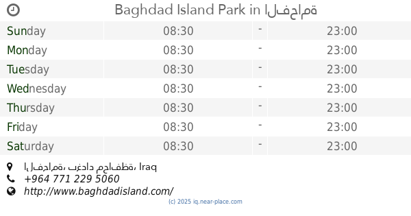
Baghdad Island Park
الفحامة
Park
Point of interest
Establishment
read more
18.157 km
مضيف مصطفى العبيدي
C8RM+6RH, Tajiyat
Campground
Park
Lodging
Point of interest
Establishment
read more
📑
all categories
Accounting
Airport
Amusement park
Aquarium
Art gallery
Atm
Bakery
Bank
Bar
Beauty salon
Bicycle store
Book store
Bowling alley
Bus station
Cafe
Campground
Car dealer
Car rental
Car repair
Car wash
Casino
Cemetery
Church
City hall
Clothing store
Convenience store
Courthouse
Dentist
Department store
Doctor
Electrician
Electronics store
Embassy
Establishment
Finance
Fire station
Florist
Food
Funeral home
Furniture store
Gas station
General contractor
Grocery or supermarket
Gym
Hair care
Hardware store
Health
Hindu Temple
Home goods store
Hospital
Insurance agency
Jewelry store
Laundry
Lawyer
Library
Liquor store
Local government office
Locality
Locksmith
Lodging
Meal delivery
Meal takeaway
Mosque
Movie theater
Moving company
Museum
Neighborhood
Night club
Painter
Park
Parking
Pet store
Pharmacy
Physiotherapist
Place of worship
Plumber
Point of interest
Police
Political
Post office
Premise
Real estate agency
Restaurant
Roofing contractor
Route
Rv park, camping
School
Shoe store
Shopping mall
Spa
Stadium
Storage
Store
Sublocality
Supermarket
Synagogue
Taxi stand
Train station
Transit station
Travel agency
University
Veterinary care
Zoo
sublocality level 1
↑