Point of interest nearby طبيبة الاسنان فاطمة العذاري
Iraq
Point of interest nearby طبيبة الاسنان فاطمة العذاري
طبيبة الاسنان فاطمة العذاري
28RH+F79, Najaf, Najaf Governorate, Iraq
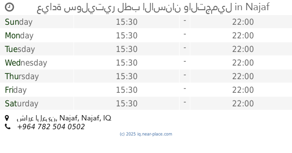
contacts phone
:
+964
Latitude:
32.0365086
, Longitude:
44.3324947
larger map & directions
read more
nearest Point of interest
17 m
عيادة د. رسل كرماشة لطب الاسنان
28PJ+MX2, Najaf
Dentist
Health
Point of interest
Establishment
read more
965 m
كوزمتك للاسنان
28HP+GWX, السلام،, Najaf
Dentist
Health
Point of interest
Establishment
read more
1.026 km
عيادة سوليتير لطب الاسنان والتجميل
حي الغري, شارع العين, Najaf
Dentist
Health
Point of interest
Establishment
read more
1.051 km
عيادة العريش لطب الاسنان
28GM+VJ2, شارع العين, Najaf
Dentist
Health
Point of interest
Establishment
read more
1.091 km
مفرزة الرضا (ع) الطبية
28HF+XH7, 9, Najaf
Hospital
Health
Point of interest
Establishment
read more
1.138 km
مستشفى الحكيم
28JC+JQR, Najaf
Hospital
Health
Point of interest
Establishment
read more
1.138 km
مركز صحي الداخلة
28JC+JQR, Najaf
Hospital
Health
Point of interest
Establishment
read more
1.138 km
شركة المسرة للتوصيل السريع
28JC+JQR, Najaf
Post office
Finance
Point of interest
Establishment
read more
1.158 km
عيادة الدكتور حسن الحكيم
28MC+V5J, النجف
Dentist
Point of interest
Health
Establishment
read more
1.382 km
مركز أور لزراعة الشعر- ur clinic
28FH+PX4, Najaf
Hospital
Health
Point of interest
Establishment
read more
1.644 km
عيادة النبراس
28Q8+536, النجف
Dentist
Health
Point of interest
Establishment
read more
1.663 km
مقهى ريحانه
28CJ+J9V, Najaf
Cafe
Store
Food
Point of interest
Establishment
read more
1.76 km
العراق محافظة النجف
28FR+2F5, Najaf
Post office
Finance
Point of interest
Establishment
read more
1.828 km
عيادة الدكتور ستار الحميدات
28CP+469, Najaf
Dentist
Health
Point of interest
Establishment
read more
1.864 km
شركة المغوار للصيرفة
383G+2QW, Najaf
Bank
Finance
Point of interest
Establishment
read more
📑
all categories
Accounting
Airport
Amusement park
Aquarium
Art gallery
Atm
Bakery
Bank
Bar
Beauty salon
Bicycle store
Book store
Bowling alley
Bus station
Cafe
Campground
Car dealer
Car rental
Car repair
Car wash
Casino
Cemetery
Church
City hall
Clothing store
Convenience store
Courthouse
Dentist
Department store
Doctor
Electrician
Electronics store
Embassy
Establishment
Finance
Fire station
Florist
Food
Funeral home
Furniture store
Gas station
General contractor
Grocery or supermarket
Gym
Hair care
Hardware store
Health
Hindu Temple
Home goods store
Hospital
Insurance agency
Jewelry store
Laundry
Lawyer
Library
Liquor store
Local government office
Locality
Locksmith
Lodging
Meal delivery
Meal takeaway
Mosque
Movie theater
Moving company
Museum
Neighborhood
Night club
Painter
Park
Parking
Pet store
Pharmacy
Physiotherapist
Place of worship
Plumber
Point of interest
Police
Political
Post office
Premise
Real estate agency
Restaurant
Roofing contractor
Route
Rv park, camping
School
Shoe store
Shopping mall
Spa
Stadium
Storage
Store
Sublocality
Supermarket
Synagogue
Taxi stand
Train station
Transit station
Travel agency
University
Veterinary care
Zoo
sublocality level 1
↑